Function to create a polygon fishnet of specified resolution
over a raster dataset. By default, the fishnet is built so that
each cell corresponds to a raster cell. If the pix_for_cell argument is
set, then the polygons of the fishnet are built so to include the specified
number of cells in each direction. If the cellsize option is set, a fishnet
of the specified resolution is created over the extent of the raster)
create_fishnet(in_obj, pix_for_cell = 1, shape = "rect",
  cellsize = NULL, exact_csize = TRUE, out_file = NULL,
  out_type = "sf", overwrite = TRUE, crop_layer = NULL,
  verbose = TRUE)
Arguments
| in_obj |
raster/vector file or object, or sprawlext object on which extent
the fishnet should be built |
| pix_for_cell |
numeric(1/2) (optional) 1/2 element numeric array
specifying how many pixels of the #' raster will be included in each
polygon of the fishnet (if only one element is provided, the #' same number
of pixel is aggregated in each direction). Ignored if cellsize is not null,
Default: 1
|
| shape |
character [\"rect\" \"hex\"]
|
| cellsize |
numeric(1/2) (optional) 1/2 element array specifying the
dimensions of the desired #' cells in the x and y directions (if only one
element is provided, the same cellsize is used in each direction),
Default: NULL
|
| out_file |
logical PARAM_DESCRIPTION, Default: FALSE.
|
| out_type |
character [sf, sfc] if sf, return an sf POLYGON
object, with a cell_id column. If sfc return only the geometry, default: sf
|
| overwrite |
logical PARAM_DESCRIPTION, Default: TRUE.
|
| crop_layer |
logical object of class Extent. If not null, the
fishnet is cropped on this extent, without "moving" the nodes of the grid.
This is useful to crop a grid created on the basis of a different raster
coordinates on top of a different raster, Default: FALSE. CURRENTLY NOT
IMPLEMENTED - MAY BE DEPRECATED !
|
| verbose |
logical If FALSE, processing messages are suppressed,
Default: TRUE.
|
Value
OUTPUT_DESCRIPTION
Details
DETAILS
Examples
#> Loading required package: lattice
#> Loading required package: latticeExtra
#> Loading required package: RColorBrewer
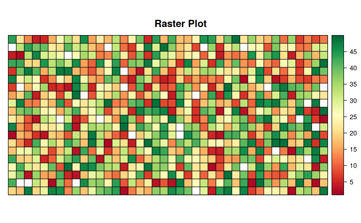
#> create_fishnet --> Creating Fishnet over in_rast
#> crop_vect --> cropping . on extent of in_obj
#> although coordinates are longitude/latitude, st_intersection assumes that they are planar
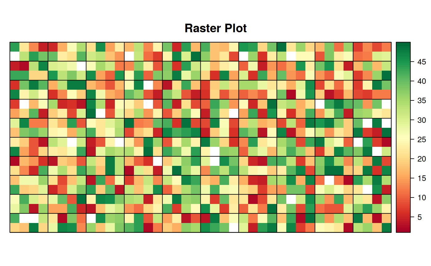
#> create_fishnet --> Creating Fishnet over in_rast
#> crop_vect --> cropping . on extent of in_obj
#> although coordinates are longitude/latitude, st_intersection assumes that they are planar
#> create_fishnet --> Creating Fishnet over in_rast
#> crop_vect --> cropping . on extent of in_obj
#> although coordinates are longitude/latitude, st_intersection assumes that they are planar
#> create_fishnet --> Creating Fishnet over in_rast
#> although coordinates are longitude/latitude, st_relate_pattern assumes that they are planar
#> Error in create_fishnet(in_rast, cellsize = c(25, 25), exact_csize = TRUE, shape = "hex"): object 'fish' not found