Perform a "dissolve" (a.k.a. aggregation) operation on a vector object according to a grouping variable, also aggregate values of the attribute table for all other columns over the same grouping variable.
Aggregation of factor or character columns is done as follows:
- If all polygons that are aggregated to a common dissolved polygon had
the same value for the column, then the value is preserved;
- If polygons had different values, the column takes the value "variable"
or NA (depending on var_as_NA )
Aggregation of factor or character columns is done as follows:
- If the column represent a "quantity" (e.g., Population), the value for each
  dissolved is computed as the sum of the values of the original
  polygons belonging to it;
TODO - If the column represents a "density" (e.g., ton ha-1), the value for each dissolved is computed as the average of the values of the original polygons belonging to it, weighted by their area; STILL TO BE IMPLEMENTED ! CURRENTLY ALL COLUMNS ARE COMPUTED SIMPLY AS THE SUM !!!!
dissolve_vect(in_vect, dissolve_var, var_as_NA = FALSE,
  out_file = NULL, out_type = "vectobject", overwrite = FALSE,
  verbose = TRUE)
Arguments
| in_vect | Either a |
|---|---|
| dissolve_var |
|
| var_as_NA |
|
| out_file |
|
| out_type |
|
| overwrite |
|
| verbose |
|
Value
an *sf object. The object is also saved to disk as a shapefile if
out_file is provided
Examples
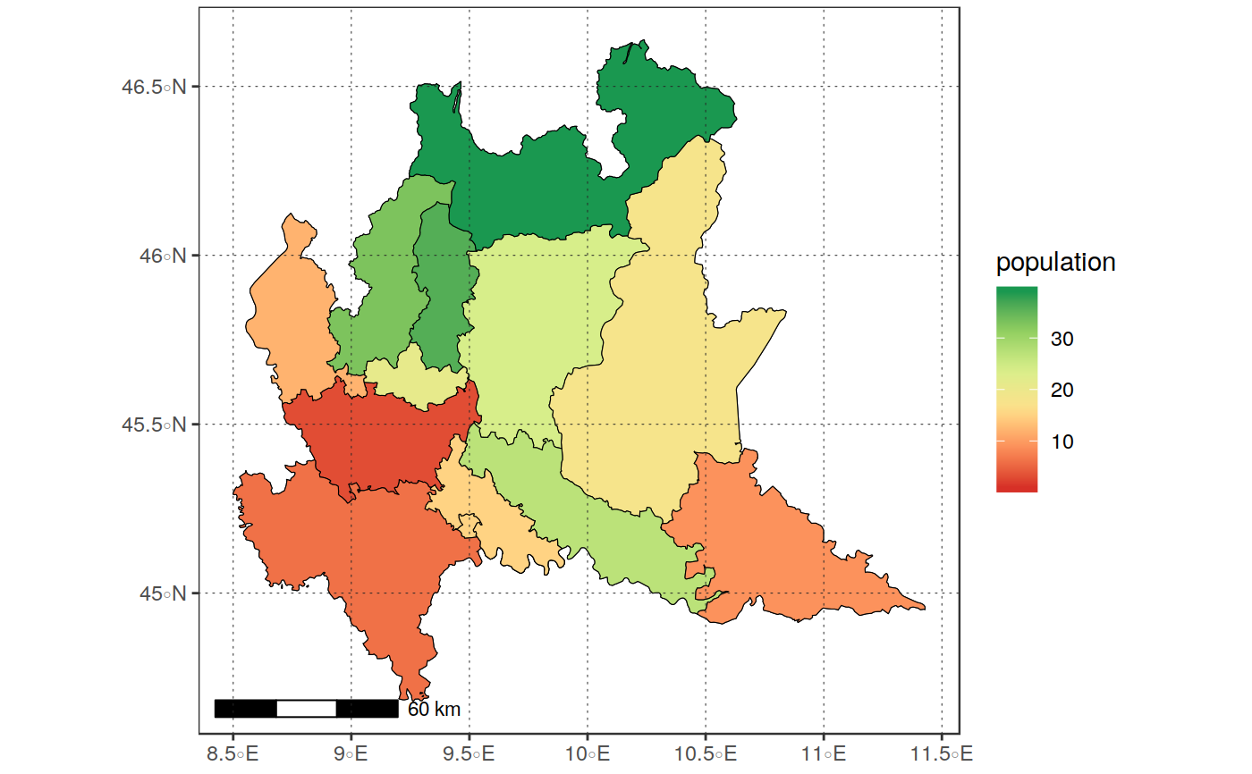
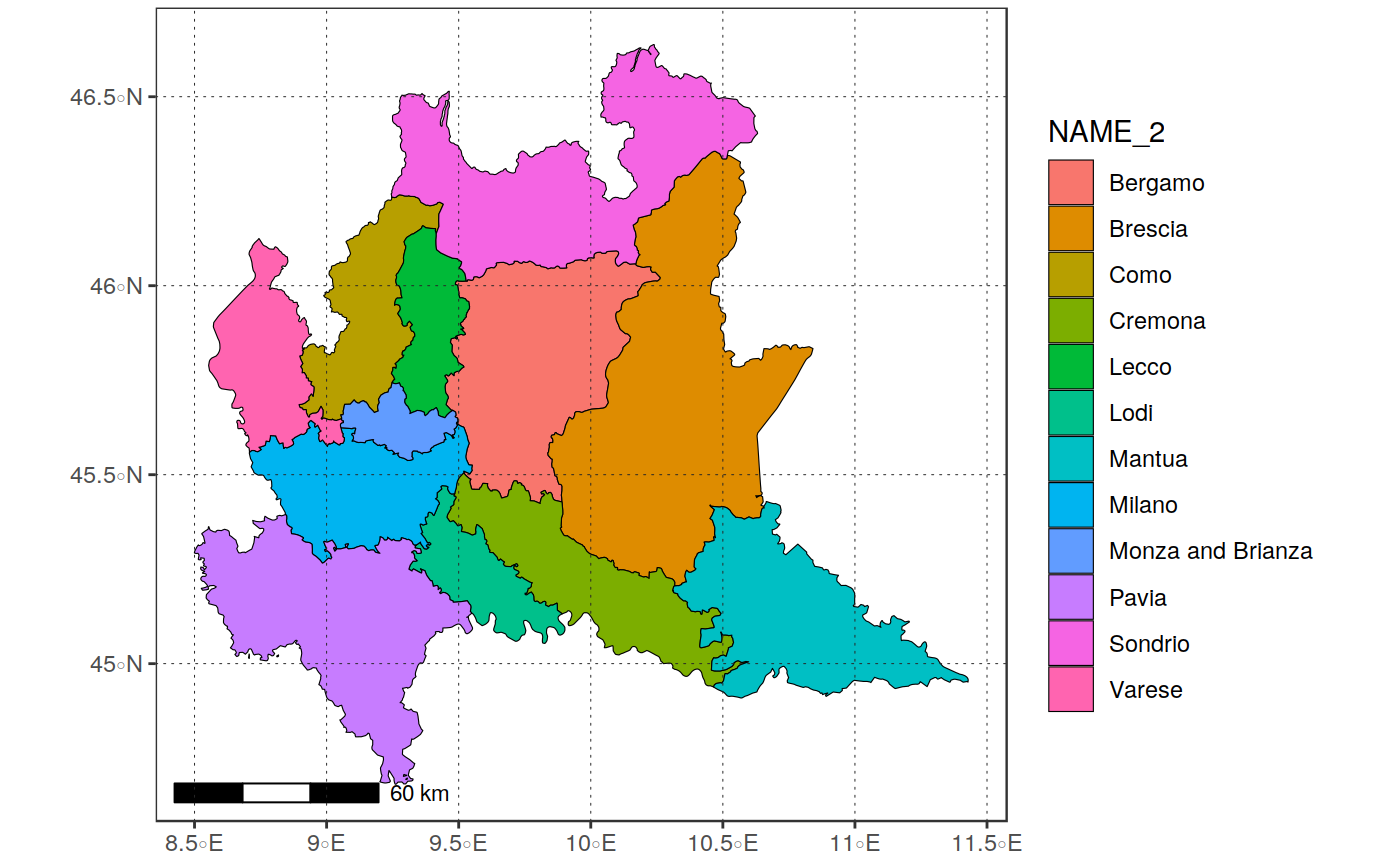
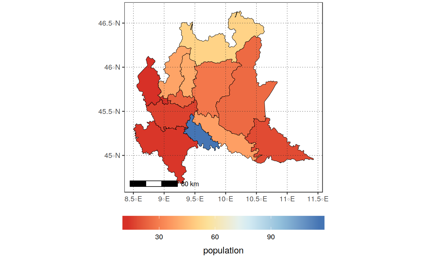
library(sprawl.data) library(maps) in_vect <- get(load(system.file("extdata/shapes","poly_lomb.RData", package = "sprawl.data"))) plot_vect(in_vect, fill_var = "NAME_2")#>#>#>#># Dissolve the vector to provinces diss <- dissolve_vect(in_vect, "NAME_2")#>#> Warning: Column `NAME_2` joining factor and character vector, coercing into character vectordiss#> Simple feature collection with 12 features and 4 fields #> geometry type: GEOMETRY #> dimension: XY #> bbox: xmin: 8.49941 ymin: 44.6809 xmax: 11.42868 ymax: 46.63806 #> epsg (SRID): 4326 #> proj4string: +proj=longlat +datum=WGS84 +no_defs #> # A tibble: 12 x 5 #> NAME_2 NAME_1 year population geometry #> <chr> <fct> <chr> <dbl> <GEOMETRY [°]> #> 1 Bergamo Lombar… varia… 28 POLYGON ((10.10427 46.08951, 10.10582 4… #> 2 Brescia Lombar… varia… 25 POLYGON ((10.50012 46.33554, 10.51088 4… #> 3 Como Lombar… varia… 39 POLYGON ((9.295499 46.23737, 9.302701 4… #> 4 Cremona Lombar… varia… 38 POLYGON ((9.551826 45.46125, 9.57864 45… #> 5 Lecco Lombar… varia… 41 POLYGON ((9.491518 46.07167, 9.49338 46… #> 6 Lodi Lombar… varia… 116 POLYGON ((9.532625 45.16629, 9.529924 4… #> 7 Mantua Lombar… varia… 18 POLYGON ((10.69031 45.42357, 10.69465 4… #> 8 Milano Lombar… varia… 16 POLYGON ((8.955621 45.6264, 8.956942 45… #> 9 Monza and… Lombar… varia… 23 POLYGON ((9.260717 45.74068, 9.261759 4… #> 10 Pavia Lombar… varia… 14 MULTIPOLYGON (((8.814569 45.01818, 8.81… #> 11 Sondrio Lombar… varia… 51 POLYGON ((10.25107 46.6226, 10.2514 46.… #> 12 Varese Lombar… varia… 13 POLYGON ((8.772502 46.10313, 8.774683 4…#>#>#>#>#>